This post is part of our ongoing blog series that acknowledges the ancestral lands on which the National Archives’ buildings are situated across the country. This series of acknowledgements is a simple way to offer our recognition and respect to the people who once lived on these lands.
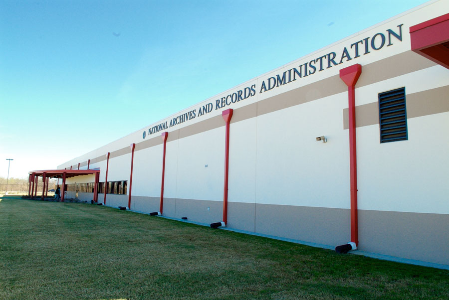
The National Archives at Fort Worth and Federal Records Center is located in Fort Worth, Texas, which is situated on lands that are rich in the history of numerous indigenous peoples. Nations with territories overlapping on the present-day address of the National Archives at Fort Worth, include the Comanche, Kickapoo, Jumano, Tawakoni, and Wichita peoples.

The area where the current Fort Worth Archives building is located is near the Trinity River and its tributaries such as Village Creek. The building is located near the current boundary between the cities of Fort Worth and Arlington. The building is part of an industrial/manufacturing area that is serviced by multiple railroad lines.

(see article: Battle of Village Creek, Texas State Historical Association).

Inhabitants of villages along Village Creek that became the city limits of Fort Worth and Arlington included Caddo, Cherokee, and Tonkawa peoples. This area was the site of the 1841 Battle of Village Creek, now Lake Arlington.
The National Archives at Fort Worth building is located in Tarrant County which was inhabited by the following tribes at different times: Tonkawa, Hasinai Caddo, Comanche, Kiowa, and Wichita.
“Little is known of the Indians who inhabited the area of present-day Tarrant County before the coming of European explorers in the sixteenth century. Groups thought to have been in the area were the Tonkawas and the Hasinai Caddos. By the late 1700s the Comanches, Kiowas, and Wichitas had also moved into the region. When White settlers came they clashed with the native population. The battle of Village Creek occurred in 1841. A seventy-man force, led by Gen. Edward H. Tarrant, seized and destroyed three Indian villages. Although this expedition and others like it cleared permanent Indian settlements from the area, trouble with the Comanches and Kiowas continued into the 1870s.”
From the Tarrant County Historical Association website.
Peoples who lived along the present Fort Worth/Arlington border included: Caddos, Hainais, Anadarkos, and fragmentary groups of Cherokee, Creek, Seminole, Waco, and Kickapoo peoples.
Enter your address in this interactive map of Traditional Native Lands to see who once lived where you are now.
My thanks to Michael Wright, Director of Archival Operations, Melinda Johnson, Archives Specialist, and Stacey Wiens, Archives Specialist, National Archives at Fort Worth, who researched the information for this land acknowledgement.
Additional Information:
Maps


1835-1854 Map showing tribe locations in the Ft Worth area around the time of the Bird’s Fort treaty.
From the Texas Beyond History website, with permission from the author.


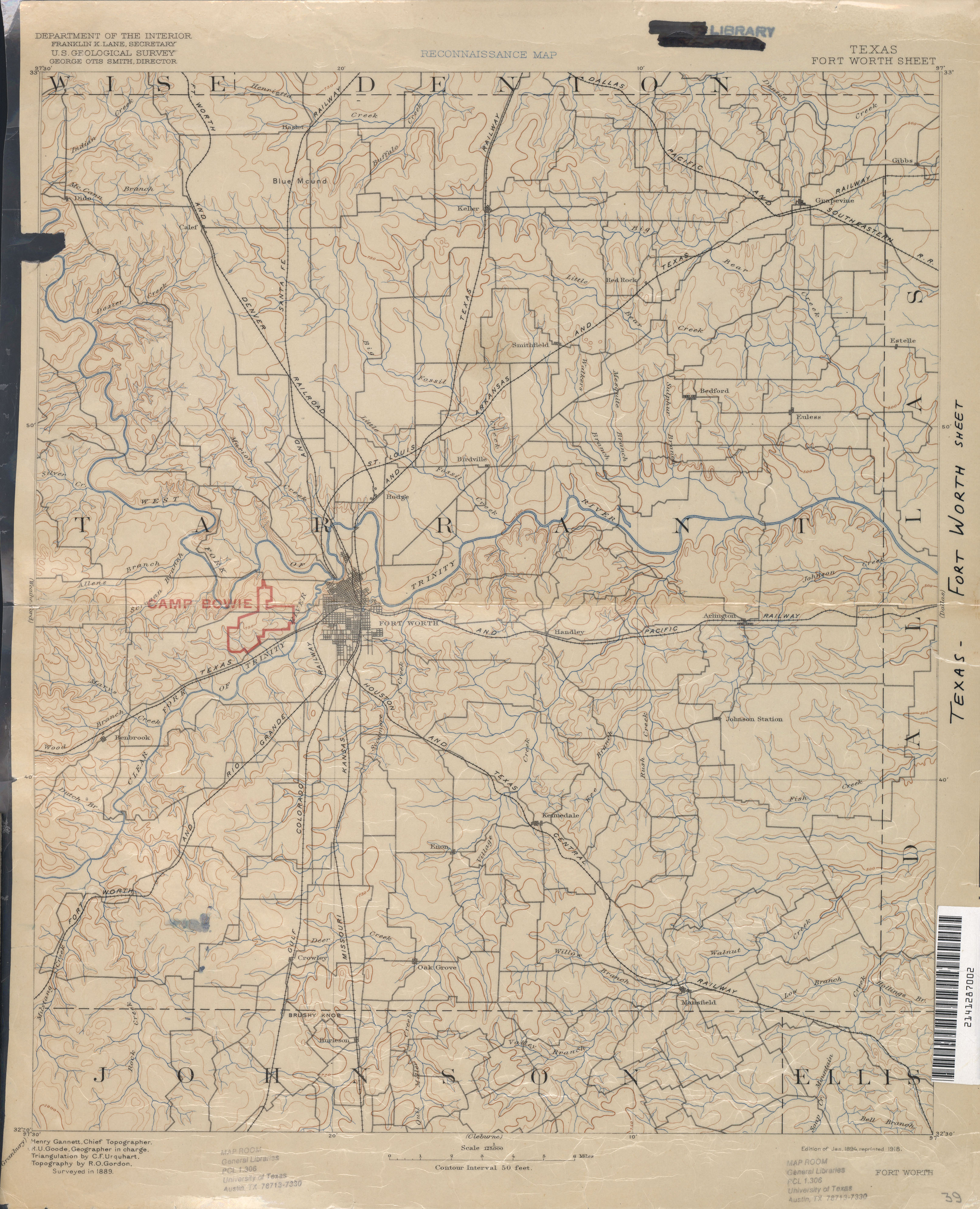
1889 Topographic map that shows Village Creek, railroads, and the town Enon that no longer exists –all in the general area where the archives building is now. Zoom of future location of National Archives at Fort Worth building. Village Creek is visible. From the University of Texas Libraries Map Collection

General Information: Tribes in Texas
Native American Relations in Texas, Texas State Library
Indigenous Peoples of Texas, FamilySearch
Tribe-Specific Information
Caddo
Caddo Nation, Southern Plains Tribal Health Board
Caddo, Texas State Historical Association
Caddo Fundamentals, Texas Beyond History
Caddo Voices, Texas Beyond History
Early Caddo History, National Park Service
Cherokee
Cherokee, Texas State Historical Association
Comanche
Comanche, Texas State Historical Association
Creek
Creek, Texas State Historical Association
Jumano
Jumano, Texas State Historical Association
Kickapoo
Kickapoo, Oklahoma Tribe website
Kickapoo, Kansas Tribe website
Kickapoo, Texas State Historical Association
Seminole
Seminole, Texas State Historical Association
Tawakoni
Tawakoni, Texas State Historical Association
Tawakoni, Oklahoma Historical Society
Tonkawa
Tonkawa, Texas State Historical Association
Wichita
Wichita Historical Resources, Wichita Tribes
Wichita, Texas State Historical Association
Additional Resources:
Introduction to Archeology, Prehistory, and Historic Sites, Texas Historical Commission, Archeology
Native American Relations, Texas State Library
Border Land: The Struggle for Texas, 1820-1879,University of Texas Arlington
Battle of Village Creek overview, Texas State Historical Association
Overview of Tarrant County history, Texas State Historical Association
National Archives Research Guides:
Guide to Native Communities Desert Southwest (see the Texas section), National Archives
Central Plains Native Communities Research Guide
National Archives Catalog:
Land and Railroads
As seen in the map above from 1889, railroads run very close to the present-day site of the National Archives at Fort Worth. As railroad companies sought expansion of the lines in the 1800s, questions arose as to whether the railways were passing through tribal land, legally or not, etc.
Letters Received, 1887, File No. 6811, Record Group 94: Records of the Adjutant General’s Office, 1762 – 1984
In 1887, Cheyenne and Arapaho questioned the legality of railroads being built across their lands. These are internal War Department letters in response. Refer to Acts of Congress that permit railroad companies access to these lands. Includes Fort Worth and Denver City Railroad which is a line that connects to the railways running very near the present-day site of the National Archives at Fort Worth.
Schedule of Damages for Right of Way of the Missouri, Kansas, and Texas Railway Company for its Atoka Branch Through Tribal Lands of the Choctaw Nation, Series: Railroad Right of Way Maps, 1902 – 1930, Record Group 75: Records of the Bureau of Indian Affairs, 1793 – 1999
The Missouri, Kansas, and Texas Railroad runs very close to the present-day site of NA at FTW.
Map of the Province of Texas
“This map was captured from the Ninth Division of the Imperial Mexican Army during the Mexican-American War.” [trails of tribes are marked]
Treaties
Ratified Indian Treaty 197: Caddo – Agency House, Caddo Nation, Louisiana, July 1, 1835
Printed Copy of the Treaty Between the United States of America and the Caddo Nation of Indians, Concluded July 1, 1835 – Ratified February 2, 1836 (Copy 1 of 2)
See also:
Sha’chahdínnih (Timber Hill), Treaty and Abandonment, Texas Beyond History
Caddo Treaty, The University of Oklahoma College of Law Digital Commons